McLean, Texas

/home/wpcom/public_html/wp-content/blogs.dir/55d/80083171/files/2014/12/img_1148.jpg
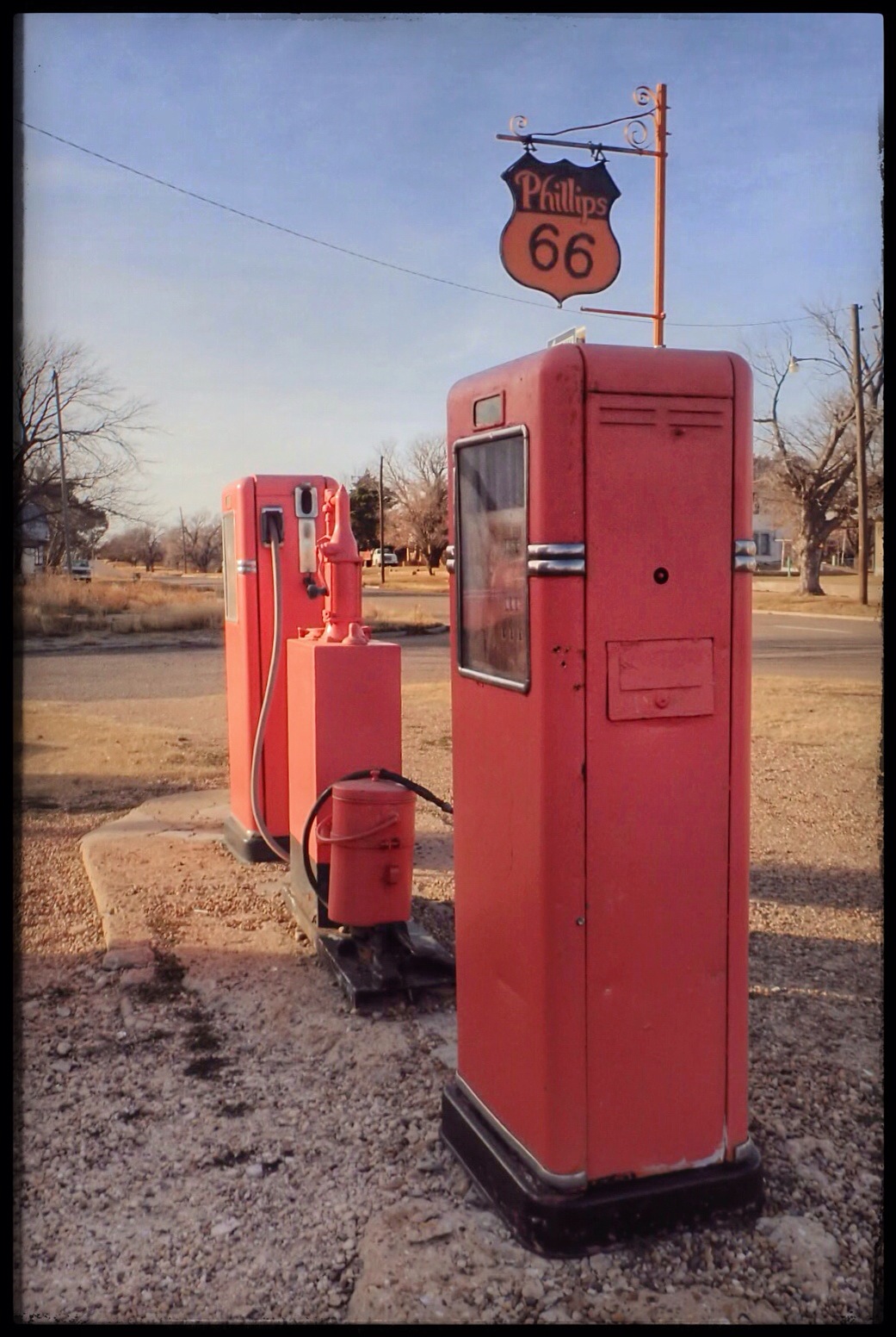
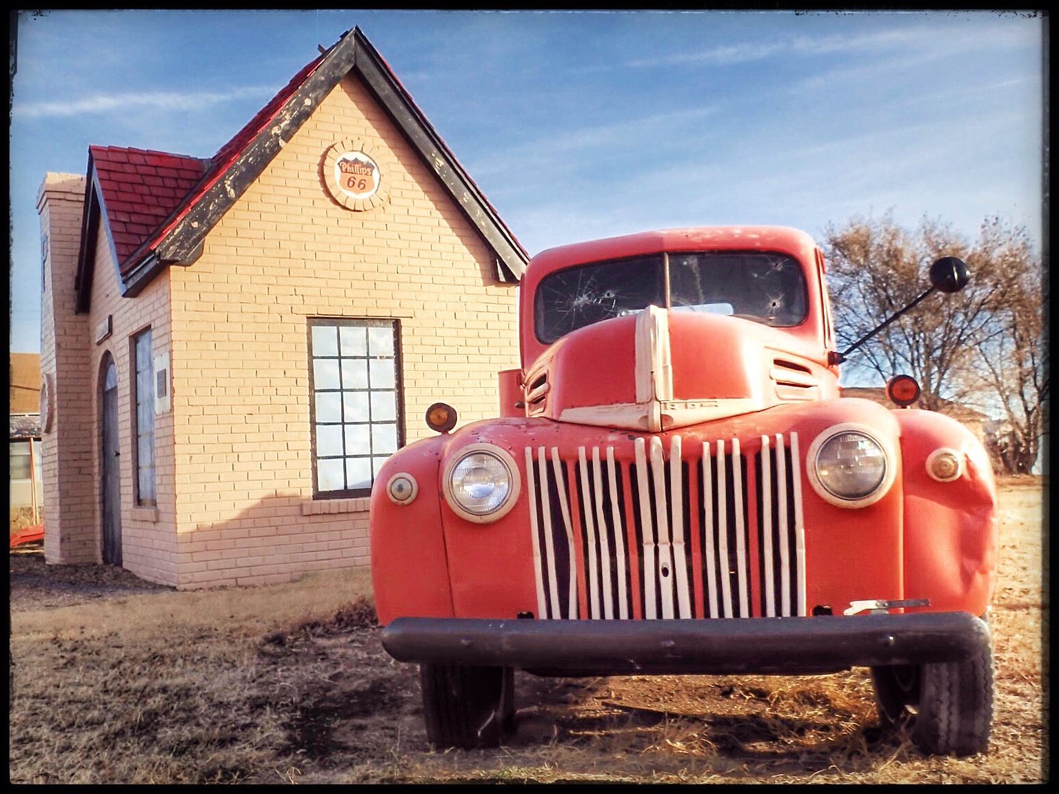
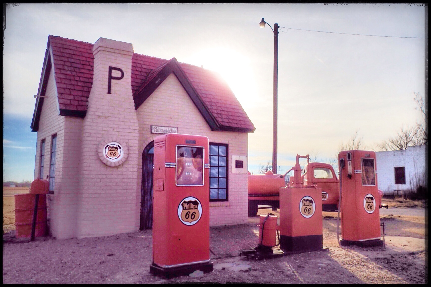
Driving east on Rt66 from Amarillo, we were eager to get to the town of McLean, home of the first Phillips 66 Station outside of Oklahoma. According to what we’d read, McLean had an active Rt66 Preservation Society and two museums. One was dedicated to a WWII POW Camp in the area (who knew?) and the other, the Devil’s Rope Museum, celebrating barbed wire and ranching history.

/home/wpcom/public_html/wp-content/blogs.dir/55d/80083171/files/2014/12/img_1152.jpg
McLean is a small town on Rt66, 75 miles east of Amarillo. During its heyday, it was a significant cattle and agricultural shipping center. As the origination point for hundreds of loads of watermelons and hogs annually, McLean employed four telegraph operators to handle the station’s communications.

/home/wpcom/public_html/wp-content/blogs.dir/55d/80083171/files/2014/12/img_1149.jpg
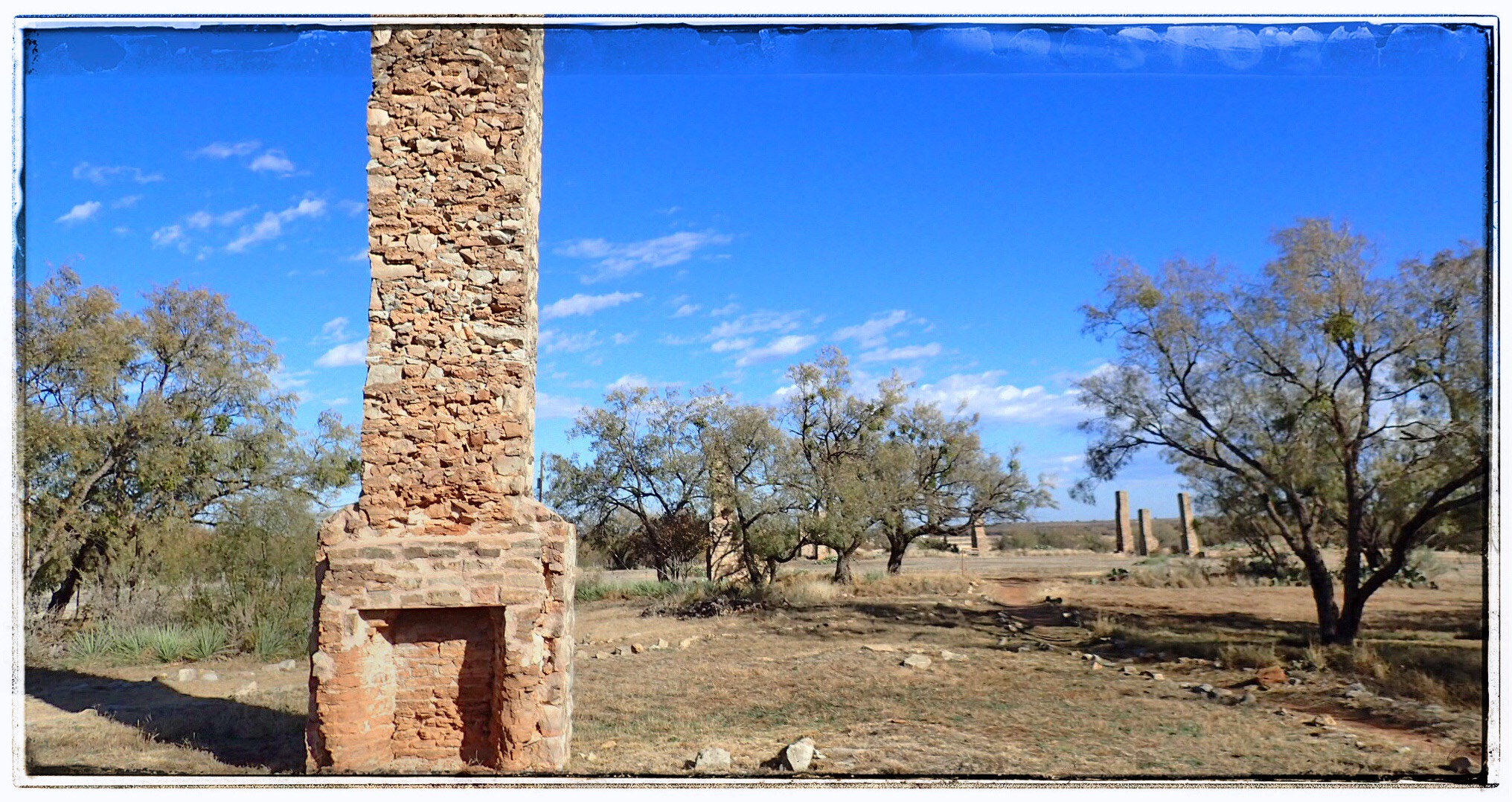
Alfred Rowe settled nearby in 1878 after learning of abundant ranchlands for purchase. Rowe was from a middle class English family, but was deprived of inheritance since he wasn’t the oldest son. So the adventurous Rowe attended the Royal Agricultural College in England before heading off to America to seek his fortune. He was an honest, hard worker, and learned Texas ranching from Charles Goodnight’s men. In 1900, he began buying land and cattle, eventually becoming one of the most successful ranchers in the Panhandle with over 72,000 acres.

When the railroad came through in 1902, he donated land for a townsite which he named for William McLean, the Railroad Commissioner of Texas. In 1910, Rowe moved his family back to England, but often returned to Texas to check on his ranch. Unfortunately, it was en route to Texas in April of 1914 that he failed to make it back. Alfred Rowe was one of the 1,517 passengers who died in the Titanic disaster.

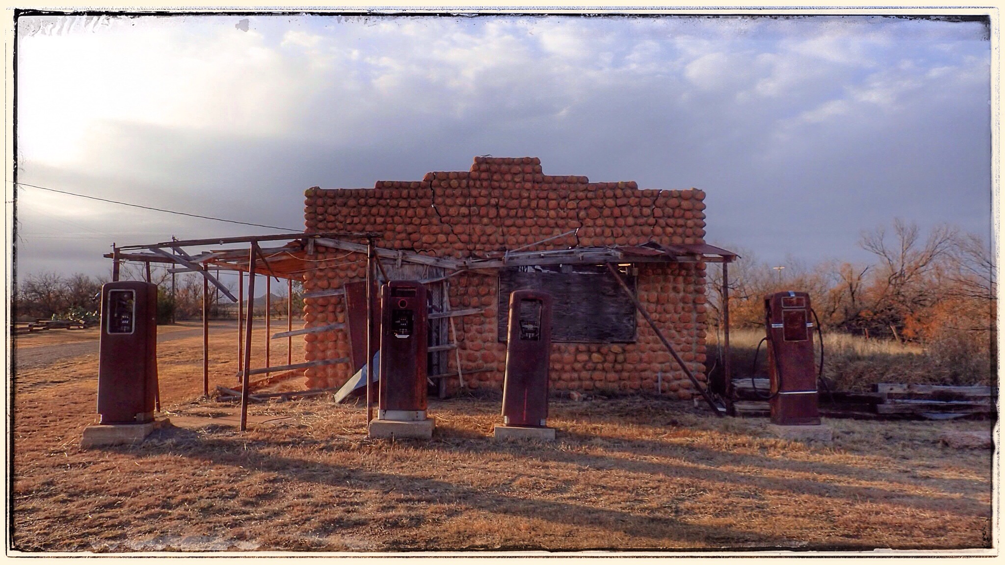
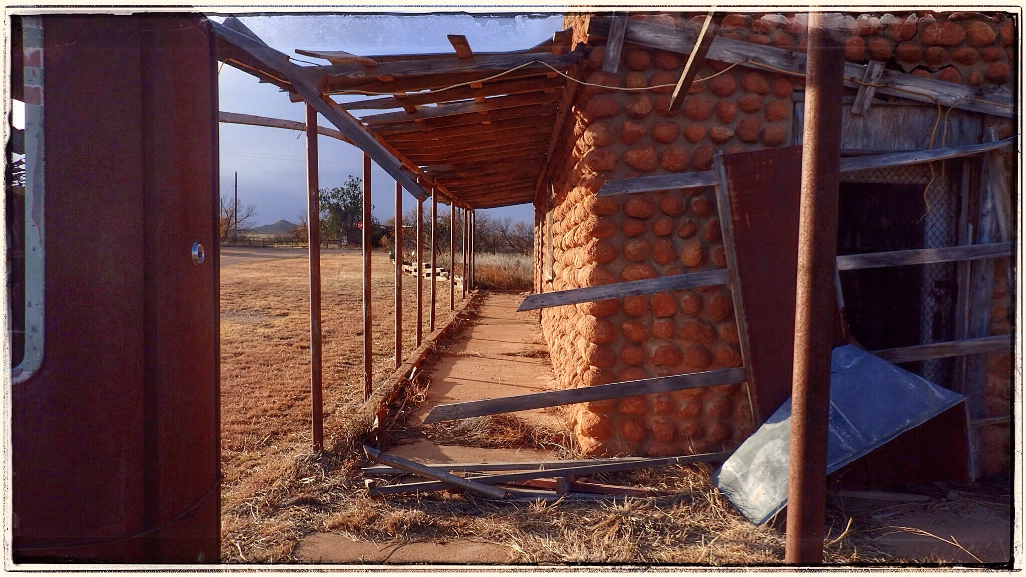
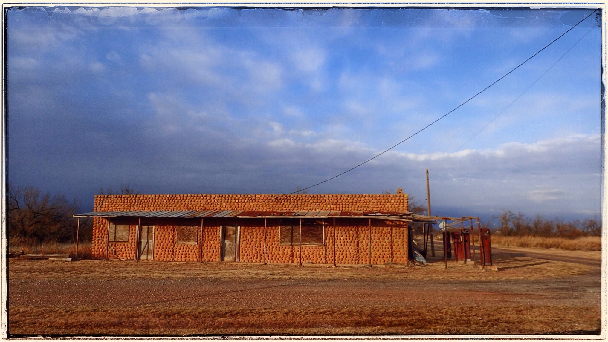
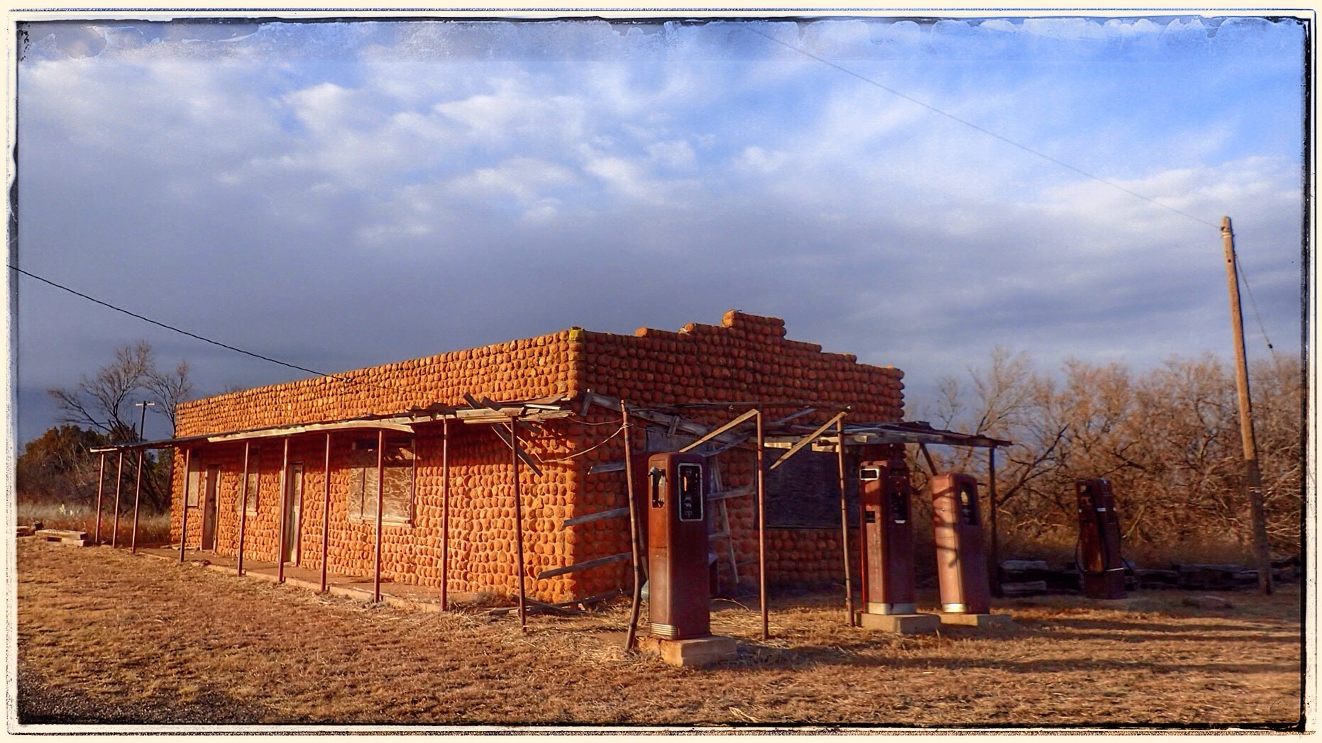
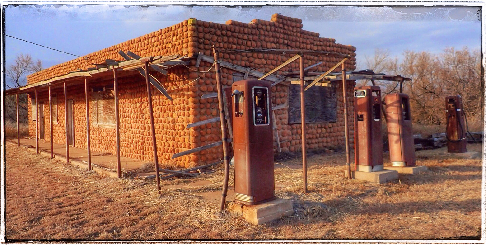
McLean benefitted from the 1927 oil boom and remained a major shipping point in the panhandle for livestock, gas, and oil. Rt66’s path through its center guaranteed growth for the next few decades, and McLane saw growth rapid growth, including the now historic Phillips 66 Station.
In 1942, the US Government established a POW Camp nearby. While the Camp provided workers to the community, the War was hard on McLean. Having 3,000 POWs so close brought the outside into this sheltered community. Many men left to join the war effort, and many of the town’s young women married soldiers and moved away.

It wasn’t until the interstate (I40) bypassed town that McLean’s future was sealed. Easier access to bigger cities contributed to the town’s decline.

/home/wpcom/public_html/wp-content/blogs.dir/55d/80083171/files/2014/12/img_1154.jpg
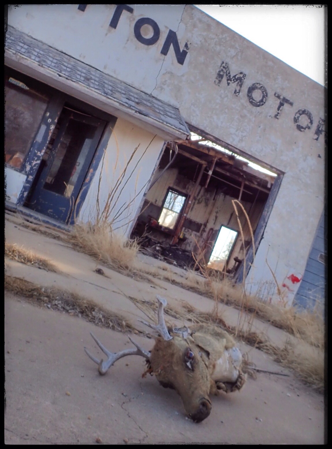
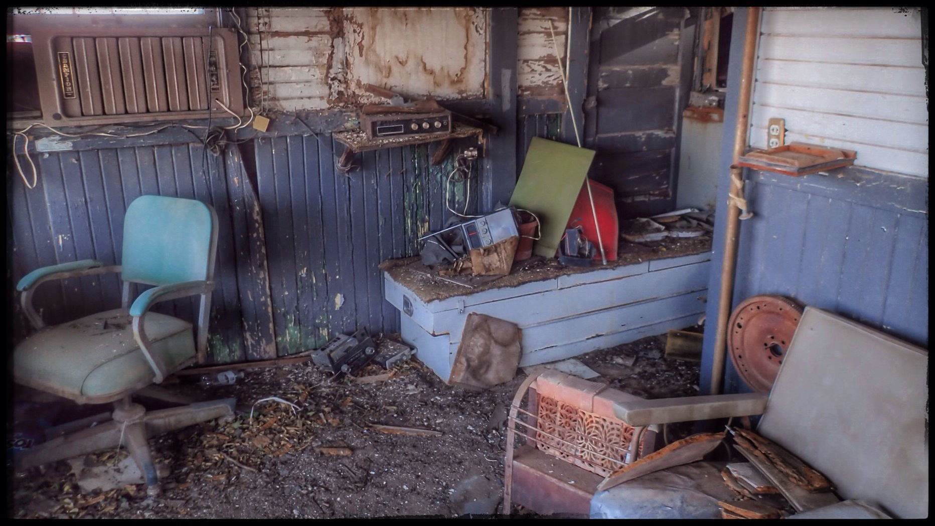
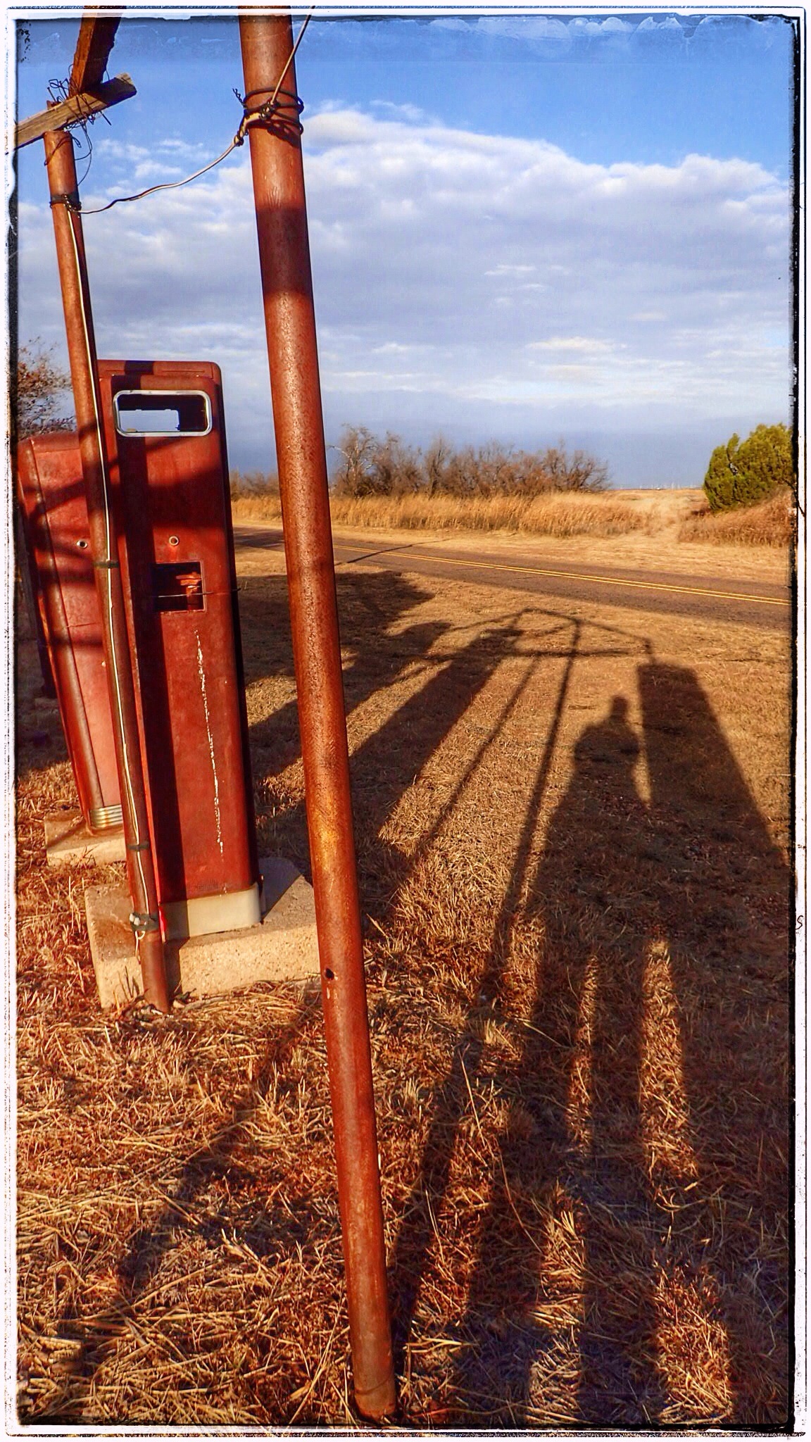
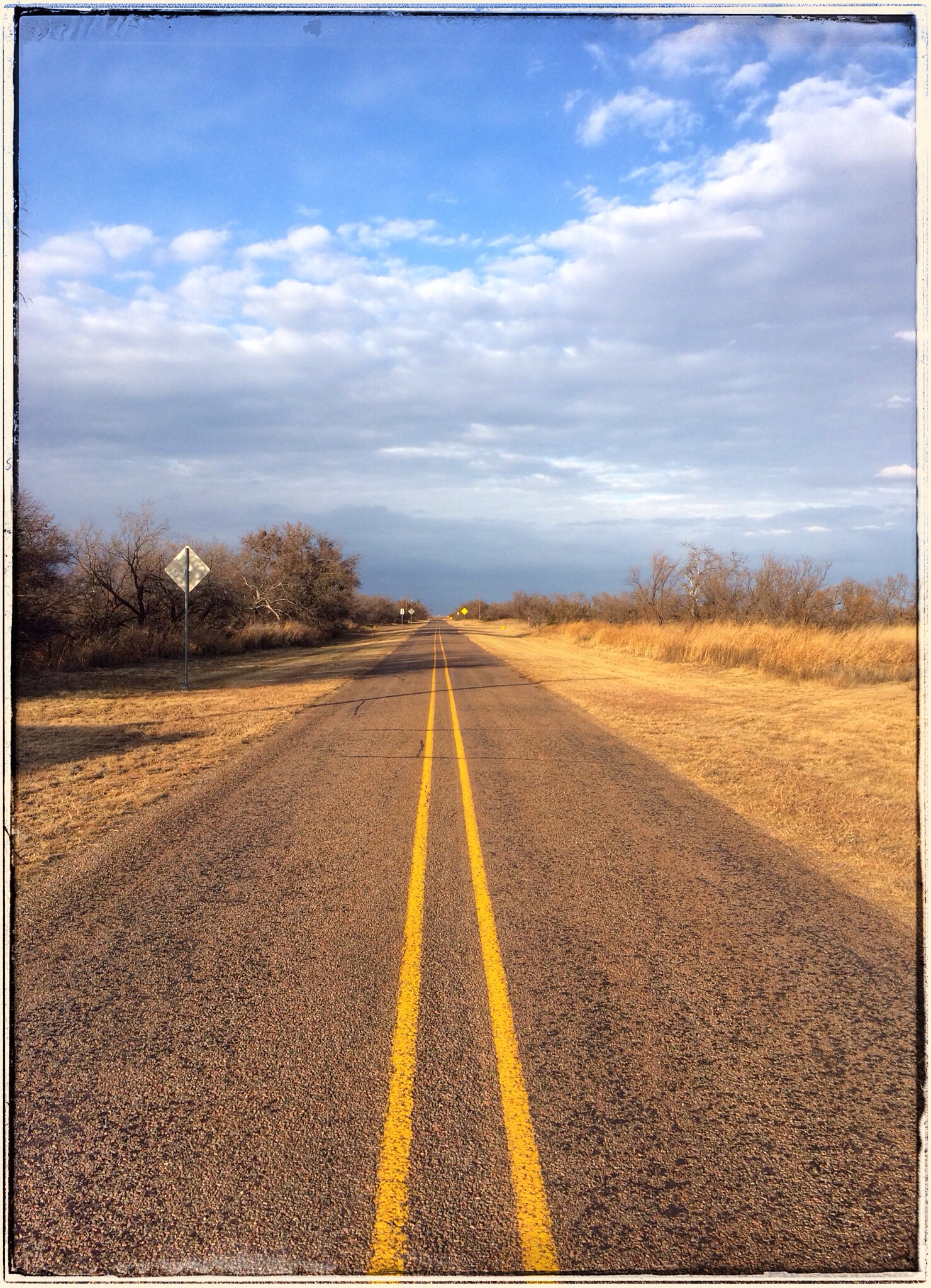
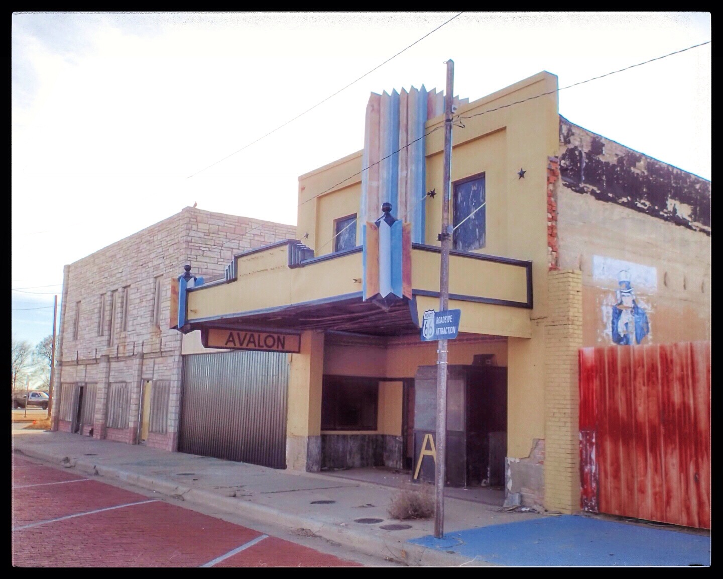
Needless to say, we were disappointed when we arrived and everything, once again, was closed. We didn’t see a soul in the hour or so we spent in town. The Devil’s Rope was closed, and the brick streets were deserted. We drove around and saw the Phillips 66, the Avalon Theatre, and many of the murals that we had seen celebrated online. Sadly, the murals and the theatre have fallen into disrepair. We’d heard there was an active Rt66 preservation society, but we saw no evidence of such.

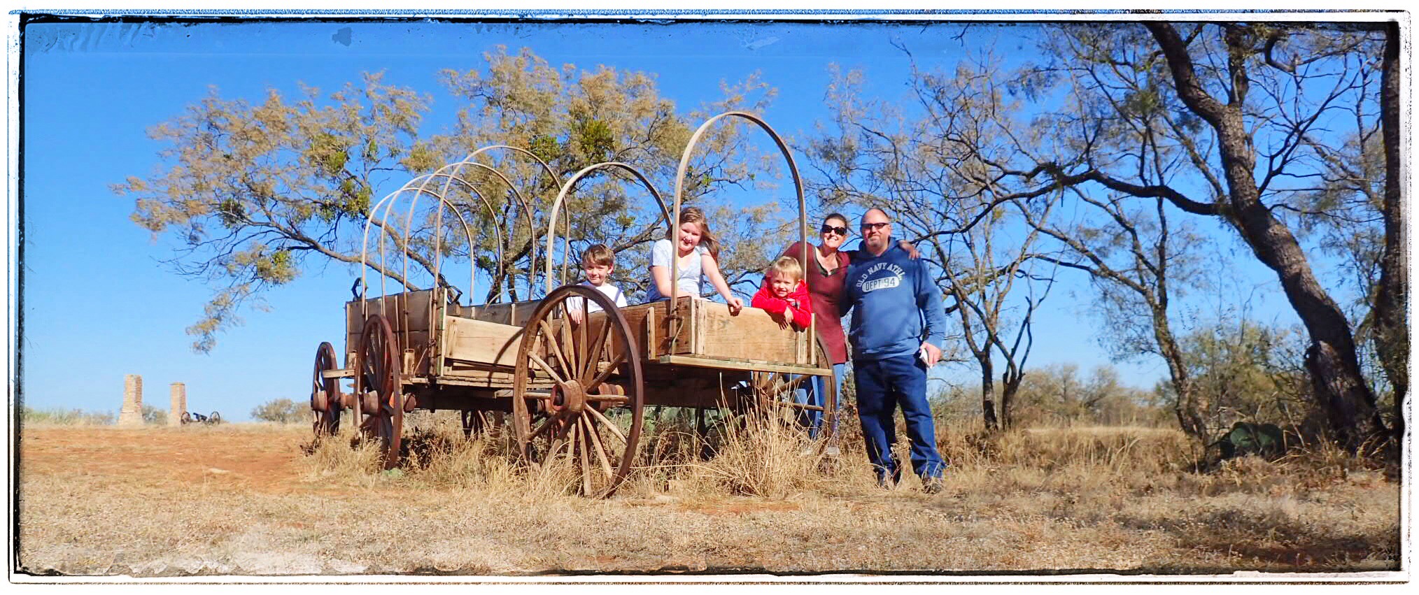
So, we drove through the deserted streets, noting the obvious historical structures (and their lack of demarcation) and wondered what the town must’ve been like in its heyday. We thought a Wednesday afternoon might have shown some signs of life, but, unfortunately, there was none. The town must’ve been a nice little place, once upon a time.

/home/wpcom/public_html/wp-content/blogs.dir/55d/80083171/files/2014/12/img_1153.jpg

/home/wpcom/public_html/wp-content/blogs.dir/55d/80083171/files/2014/12/img_1150.jpg

/home/wpcom/public_html/wp-content/blogs.dir/55d/80083171/files/2014/12/img_1156.jpg

Friendship Community, Texas

IMG_1041.JPG
Usually, the Crazy Train is the P5 family. But sometimes, we throw our nearest and dearest into the fold and enjoy whatever chaos ensues.

But yesterday was different. I’m happy to introduce– in addition to The Official P5 Line– the estrogen infused, JNJ Line of the Crazy Train. I took my BFFs Nicole and Jessica (and Jess’ son Pierce came along as the official caboose) to a typical half-day run of a Crazy Train Roadtrip, and let’s just say…. well… let’s just say that we already have the next one planned.

So, without further ado… The Inaugural Run of the JNJ Line:

We sent our kidlets off to various institutions of foundational education and we hit the road, bound for the “ghost town” of Friendship Community in Williamson County. Friendship isn’t really a ghost town, per se, since the ENTIRE TOWN is now completely submerged underneath Granger Lake. (Usually, when the three of us are submerged, it’s usually in a glass of wine, but I digress…) Granger Lake was constructed by the US Corps of Engineers in the early 1970s, creating this massive lake that is a really popular place when it’s a thousand degrees here in the summer.

IMG_1040.JPG
The town of Friendship was founded in the 1880s by Czech immigrants. By the 1920s, there was a small community with a school, grocery store, post office, churches, a cotton gin, gas station, a beer joint, and a paved road: FM 971. The MK&T Railroad even had tracks and a bridge through the immediate area. Friendship’s downfall was probably what drew the Czechs to the area in the first place: the San Gabriel River. A severe flood in 1913 caused widespread damage, a deadly flood in 1921 took several lives, and a third destructive flood in 1958 was the straw that broke the camel’s back. Finally, it was decided that it just wasn’t worth it– the San Gabriel apparently wanted Friendship so badly, the people decided that it could have it. Everything and everyone relocated and the dam and lake plans began.

Since a lot of Friendshipians (Friendshipites? Friendshipidians?) had moved over to Granger, we decided that should be our next stop. After a quick photo op at a water tower that looked just like a volleyball– OF COURSE we stopped for a triple selfie, THROUGH THE SUNROOF, because, well, why not?– we headed off to Granger.

IMG_1027.JPG
Yet, although Granger was not underwater, there didn’t appear to be anything open on a Tuesday morning. With a population of 1,419, we hoped Granger had something to offer in the way of mom and pop shops, junking, or a cool old diner or something, but no dice. Not even the Watern’ Hole Feed Bag was open. (So sad. We really wanted to know what a Boo Boo Burger was. Granger is such a picturesque town, the setting for all kinds of movies, I’ve heard. But not much I the way of businesses. I’ll have to go back and explore a little.

IMG_1035.JPG
So, next stop? Taylor!

IMG_1042.JPG
And, since we blew into Taylor at the EXACT moment Louie Mueller opened for lunch, we felt it was our DESTINY to carpe diem and see what kind of delicious Q we could score at 11:03am on a Tuesday. Every time the P5 Crazy Train has even attempted Louie Muellers, the “Sold Out” sign has been on the door and the parking lot has been empty. We decided to strike while the pit was hot!

I did feel a little guilty about hitting up Louie Muellers without the hub, but the sweet smell smoke wafting from the building quickly snuffed out those feelings! As we walked in, there was no line…. NO. LINE. And on our journey to the counter, I caught a glimpse of a beautiful beef rib. It would be mine. Oh yes. It would be mine.

IMG_1032.JPG
So, Nic and I decided to share the 1-1/2 POUND beautiful beef rib, and we threw in some beans and a slice of lean brisket for each of us, because, well, it’s kinda mandatory. And damn. It was good. However, even two fat chicks with eyes the size of serving platters couldn’t polish off that single rib. We gave it the good old college try, but, no dice. The rib defeated us.

IMG_1030.JPG
But before we called it a day and returned to reality to retrieve all the little people, we hit a few junk shops and found some treasures. I scored some pretty little amber pieces for my yellow kitchen, and Nic made an epic score of her own.

IMG_1033.JPG
Then back to reality. Until Friday, that is.

The Bug Farm, Conway, Texas

IMG_1010.JPG
The last town before Amarillo– or the first after leaving– on Old Route 66, is the ghost town of Conway, TX. Before I40 was routed 1/2 mile north of town, Conway consisted of ranchers and farmers who settled in the area in the late 1800s. The town grew after the Choctaw route of the Chicago Rock Island and Gulf Railroad came through in 1903.

IMG_1009.JPG
In 1967, the Crutchfield family opened a service station and souvenir shop at the I40 exit to Conway. Two years later, the town peaked at a whopping population of 175 people, but a year later, more than half of them had moved away. By 2000, only 20 people remained, and by 2002, the Love’s truck stop across I40 was the main draw in the immediate area. Undeterred by the big guys across the highway, one of the Crutchfields had an idea to lure in customers. He had always loved the Cadillac Ranch out west of Amarillo, so why not create a parody of the attraction east of the city? He put his knowledge of off-road equipment to use and buried five Volkswagon Beetles nose-down, a la Cadillac Ranch, in front of their station. It wasn’t long before the spray painting began.

IMG_0995.JPG
The stunt brought in the local media and drew in some customers, but it was’t enough to sustain the business. In 2003, the Crutchfields bugged out of town, and it has been abandoned ever since. But, that doesn’t stop kitsch-seekers like us from making it a destination point. I’ve heard it’s a great spot for geocaching, if you’re into that. The Bug Farm, or the Bug Ranch, or the Slug Bug Farm or the Slug Bug Ranch, or the Bugg Farm, or the Rattlesnake Curio and Souvenir Shop– whatever it’s called, all that’s left now is a deteriorating roadside attraction with Crazy Train written ALL OVER IT. (Quite literally!)

IMG_0981.JPG
Speaking of souvenir shops, I think I need to interject something here for a quick second. I was a little surprised at the lack of nick-knacks, tchotchkes, tshirts, and other miscellaneous crap available with “Rt66” emblazoned on it. Though relieved not to be nagged constantly for a bunch of crap by my kids, I am sure we could have found something wonderful that we couldn’t have lived without. I’m not sure how I’m going to survive without a Rt66 keychain, or how I am gong to feel in six months when I am not yelling at the rest of the Crazy Train when I retrieve a broken Rt66 snow globe from under the seat of the car. But I digress. Back to Conway.

IMG_0985.JPG
The Crazy Train had almost as much fun at the Bug Farm as they did at Cadillac Ranch. We climbed around an old Ford(?), took a fantastic family picture, and William even found a partially filled can of spray paint and the kids got to leave their mark both east and west of Amarillo. We were the only ones there, and it was a little warmer and slightly less windy than Cadillac Ranch had been. It’s definitely worth a stop.

IMG_0990.JPG

The Town of Medicine Mound, Texas. Population: 0

IMG_0823.JPG
While doing on-the-road recon for Ft Phantom Hill, we stumbled upon the name of a town that promised to be well worth a detour. Medicine Mound, TX has been called (by texasescapes.com) “Texas’ most interesting ghost town,” and when we see a claim like that, the first thing the Crazy Train’s Pilot and Navigatrix say is GAME ON!

This tiny town is surprisingly easy to find (unlike most ghost towns) as it’s still on most maps. Named for the nearby Medicine Mounds, the town was created when the Kansas, Mexico and Orient Railroad Co. extended their line in 1909. Almost immediately, business sprung up and more families arrived in the area. With a population of 500 and 22 businesses at its peak in 1929, Medicine Mound had promise.

IMG_0830.JPG
But the Stock Market Crash in 1929 was immediately followed by a decade of depression, drought, and dust storms. It was during this time that a bizarre series of events unfolded that would destroy this community, leaving it LITERALLY in ruins.

IMG_0833.JPG
This, my friends, is a story worth reading. (See bottom for explanation of my new word!)

IMG_0822.JPG
But first, OUR trip!
When we arrived in Medicine Mound, the cold wind was blowing a storm into town (and blowing my hair out of my ponytail!). The sun was on its way down, casting long shadows and giving everything really intense colors.

There are essentially three buildings left in town: 1.) The Cole building, which is now a museum run by a town native who lives nearby. We hear she opens for a few hours on Saturdays, but it wasn’t while we were there. 2.) The gas station, which is FLIPPING AWESOME with the old gas pumps still standing out front. 3.) The schoolhouse which is maybe 500ft away, down a dirt road (yet we were lucky enough that it was MUDDY!).

IMG_0831.JPG
Between the buildings is a little merry-go-round, so while I was kodaking at the gas station and Mark was peeking around the Cole building, the kids got to run wild. Since the biting wind had numbed our ears and we didn’t want muddy kids in the car, we drove to the schoolhouse and I jumped out and sacrificed my boots for some great pictures.

IMG_0828.JPG

IMG_0829.JPG
This place was really cool. And if it hadn’t been so windy and cold, and had the museum been open, and had the sun not been so close to setting, we might-would have stayed and kodaked a little longer.

IMG_0832.JPG
Ok, back to the history. What happened to Medicine Mound?

At about 3:00am on March 31, 1933, Mrs Ella Tidmore BURNED DOWN THE TOWN.

The sad story of the Tidmore family was mostly a well-kept, small-town, secret for more than 65 years. The act of arson was not investigated (or even reported) although over $50,000 (about $1M today) in damage had been done, and all but 2 buildings in Medicine Mound were burned to the ground.

The Tidmores were one of the first families to settle in Medicine Mound, arriving before the railroad in 1902. By all accounts, the Tidmores were the perfect family. They were socially prominent, wealthy, active members of the community. Jim Tidmore was a deacon in the church and had higher ambitions than farming– he opened the town’s first commercial real estate venture. The large, extended Tidmore family was well liked, healthy, intelligent, and good looking. But when things went bad, they went BAD. Unrequited love, extramarital affairs, prison sentences, suicide, multiple divorces, several attempted murders, drowning, untimely deaths, theft, well poisonings, several acts of arson and a tale of insanity so incredible– really, you’ve got to read it to believe it.

The lasting effect the Tidmore family had on Medicine Mound happened on the windy night of March 31, 1933. It was 3am when Ella, by then completely insane, set fire to the barber shop on the south end of town. As the fierce south winds whipped across the plains, it wasn’t long before the entire town was engulfed in flames, leaving only two businesses standing. Even the bank vault collapsed, destroying all the town and financial records. Throughout it all, neighbors said they saw Ella standing on her front lawn, laughing.

Between the destruction in 1933, a freak snowstorm in April 1938, WWII, and the Industrial Revolution, Medicine Mound quickly became one of Texas’ most fascinating ghost towns.

(Full story here: http://texashistory.unt.edu/ark:/67531/metapth26723/m1/20/)
If you have time to click around this book, it’s so awesome. It’s a book filled with hilarious (and sometimes tragic) small town stories and gossip. There is some fantastic stuff in there. I wanted to buy a copy, but I could only find one online for sale, and it was $135.00. Yeah. No. But, I have read a bunch of the stories, and from one of them, I added a new word to my vocabulary:

KODACING (or KODAKING).

the -ing form of the word, appropriate in almost every situation, of the word Kodak. As in the camera/film/etc. company. In the book, it’s spelled with a “c,” but I prefer a “k.” Example: While in Medicine Mound, I enjoyed kodaking around the town. A common pastime in Medicine Mound in the 1920s was kodaking on the Mounds. Unfortunately I don’t get to use many Kodak products anymore, but it’s my homage to George Eastman!!! It’s so DORKY it’s AWESOME!!!!

IMG_0834.JPG

IMG_0825.JPG

IMG_0824.JPG

Fort Phantom Hill

IMG_8531-0.JPG Just north of Abilene, Texas on FM600 lies the remains of Ft Phantom Hill, a little gem of a ghost town that began in the early 1850’s to protect westward moving settlers from the Commanche.

IMG_8537.JPG The Fort is at the Clear Fork of the Brazos River. It was originally planned for Elm Creek, but a new general, changed the plan. This new spot had brackish water, no wood for construction, and…. isn’t that enough? They hauled in stone from Elm Creek, 2mi away (ironic, huh?) and brought oak logs from about 40mi away.

IMG_8532-0.JPG Though never officially named, the Fort was referred to as “The Post on the Clear Fork of the Brazos.” (But I bet the soldiers called something more colorful.) The name “Fort Phantom Hill” refers to the apparitions inhabitants have claimed to have seen there from the start.

Life at the Fort– for lack of a better word– sucked. Elm Creek (2mi) was often dry. The Clear Fork’s water was brackish. The 80ft well was unreliable, and hauling water from a spring 4mi away (again) SUCKED. With this water supply, gardens couldn’t be kept and the men got scurvy, fever, pneumonia, and dysentery. The most common pastime was desertion. They say the ONLY positive thing about the Fort was the view.

IMG_8538.JPG Since virtually all Commanche encounters were peaceful, the Fort was abandoned in 1854. As troops left, the Fort was ablaze. The official report was that the Indians set the fires, but it was more likely the soldiers torched it in celebration.

IMG_8533.JPG In 1858, the structures were repaired so they could be used as a way-station for the Overland Mail Stagecoach Line. In the Civil War, it was used as a field ops base, and in 1871, it was a sub post of nearby Ft Griffin. In 1876/77, it was a buying/shipping point for buffalo hides, and by 1880, the town that had sprung up had over 500 residents. Jones was named County Seat, but 6mos later, County government had moved to Anson and the Texas & Pacific Railway was routed 14mi to the south, thus ending the run of Fort Phantom Hill.

In 1928, the site was bought by private interests, and in 1969 it was deeded to the Ft Phantom Hill Foundation to ensure its preservation.

Today, it’s one of Texas’ most pristine historic sites. Strolling among the dozen or so chimneys and buildings on the 22 acres is a spiritual experience. Entrance is free, and they have brochures and clean bathrooms. Everything is clearly marked. Don’t trust your GPS or any addresses or other directions. The site is about 15-20 minutes up FM600 from Abilene. Just keep your eyes open and you’ll see it. If you miss it, you’re not paying attention.

IMG_8529.JPG Don’t miss it. It’s a fantastic piece of history.

IMG_8535.JPG Oh yeah. If you want a family photo, bring a tripod. Finding things to make a camera stand was NOT easy. I couldn’t even find stuff to raise my fancy-schmancy little candy apple red picture making magic box… I can’t imagine trying to find stuff to build a FORT!

IMG_8540.JPG
Take only pictures,
Leave only footprints,
Keep only memories,
Kill only time,
Waste nothing,
and
Always leave a place
better than you found it.