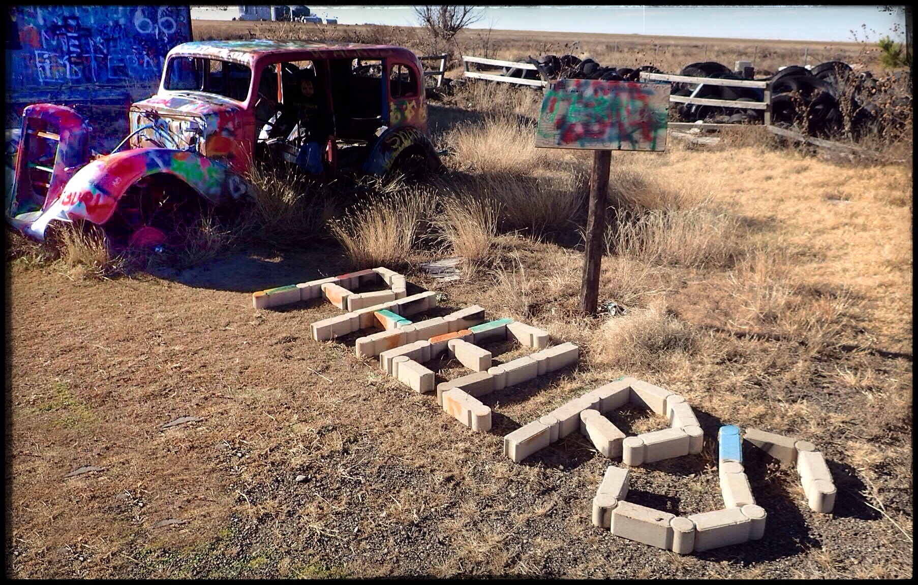
While doing on-the-road recon for Ft Phantom Hill, we stumbled upon the name of a town that promised to be well worth a detour. Medicine Mound, TX has been called (by texasescapes.com) “Texas’ most interesting ghost town,” and when we see a claim like that, the first thing the Crazy Train’s Pilot and Navigatrix say is GAME ON!
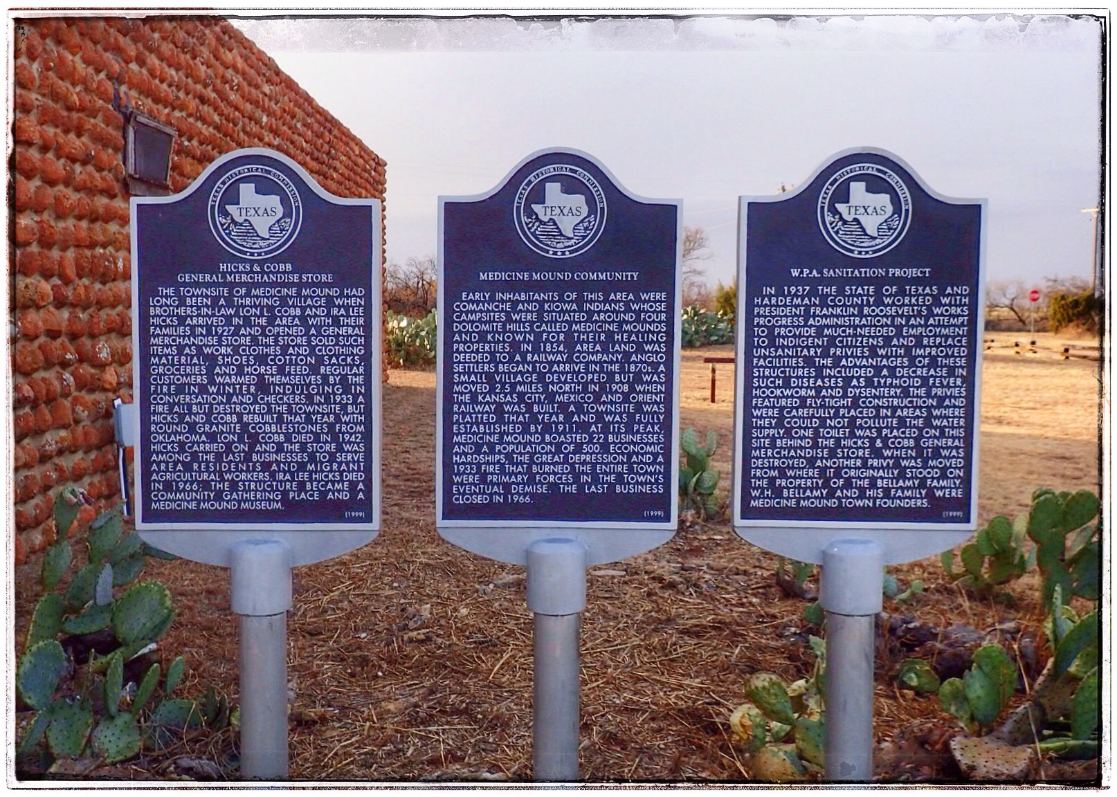
This tiny town is surprisingly easy to find (unlike most ghost towns) as it’s still on most maps. Named for the nearby Medicine Mounds, the town was created when the Kansas, Mexico and Orient Railroad Co. extended their line in 1909. Almost immediately, business sprung up and more families arrived in the area. With a population of 500 and 22 businesses at its peak in 1929, Medicine Mound had promise.
But the Stock Market Crash in 1929 was immediately followed by a decade of depression, drought, and dust storms. It was during this time that a bizarre series of events unfolded that would destroy this community, leaving it LITERALLY in ruins.
This, my friends, is a story worth reading. (See bottom for explanation of my new word!)

But first, OUR trip!
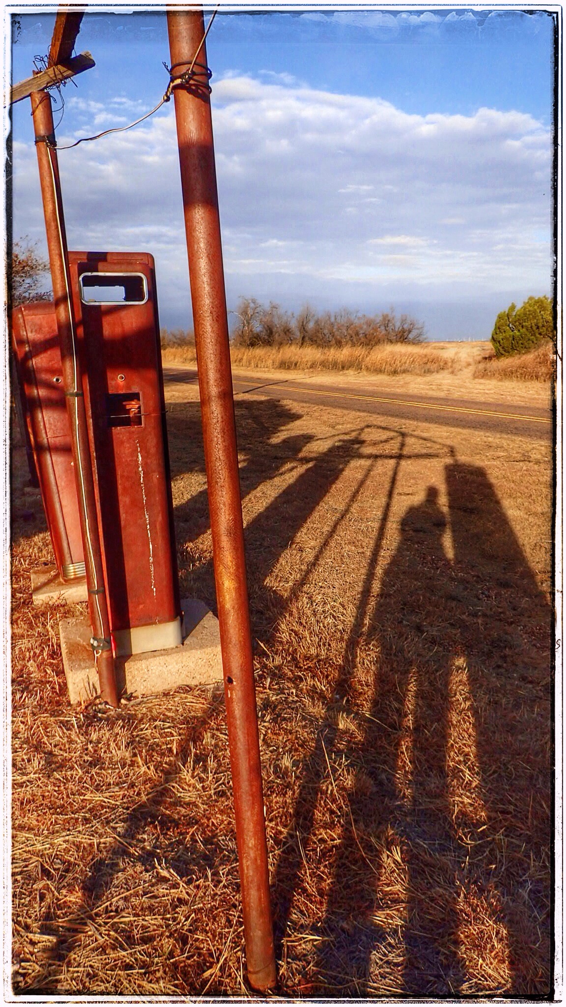
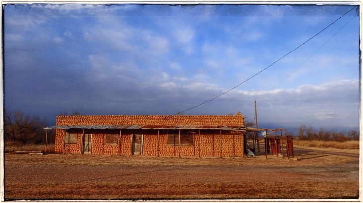
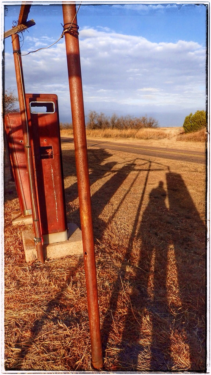
When we arrived in Medicine Mound, the cold wind was blowing a storm into town (and blowing my hair out of my ponytail!). The sun was on its way down, casting long shadows and giving everything really intense colors.
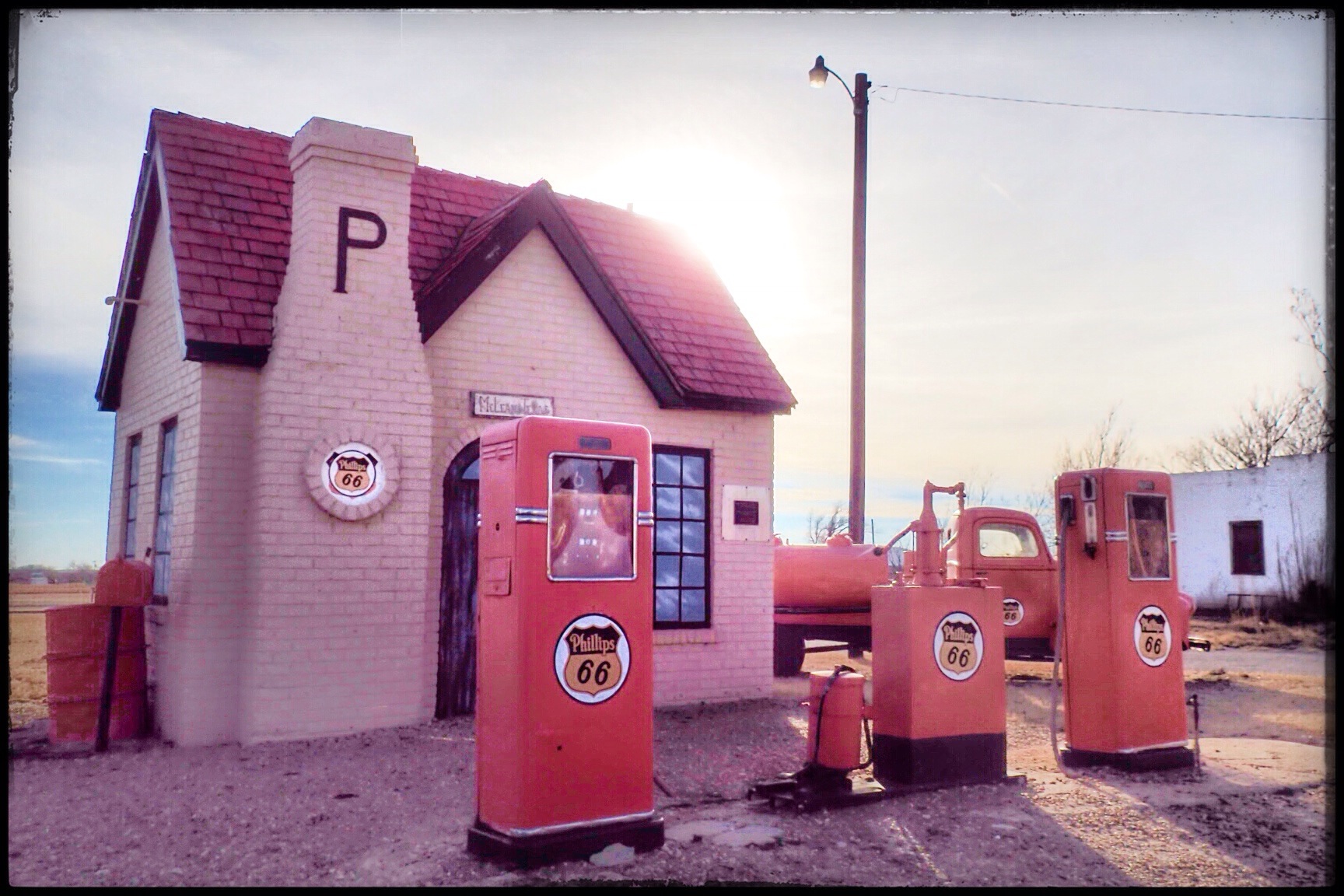
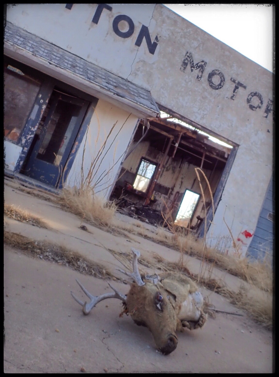
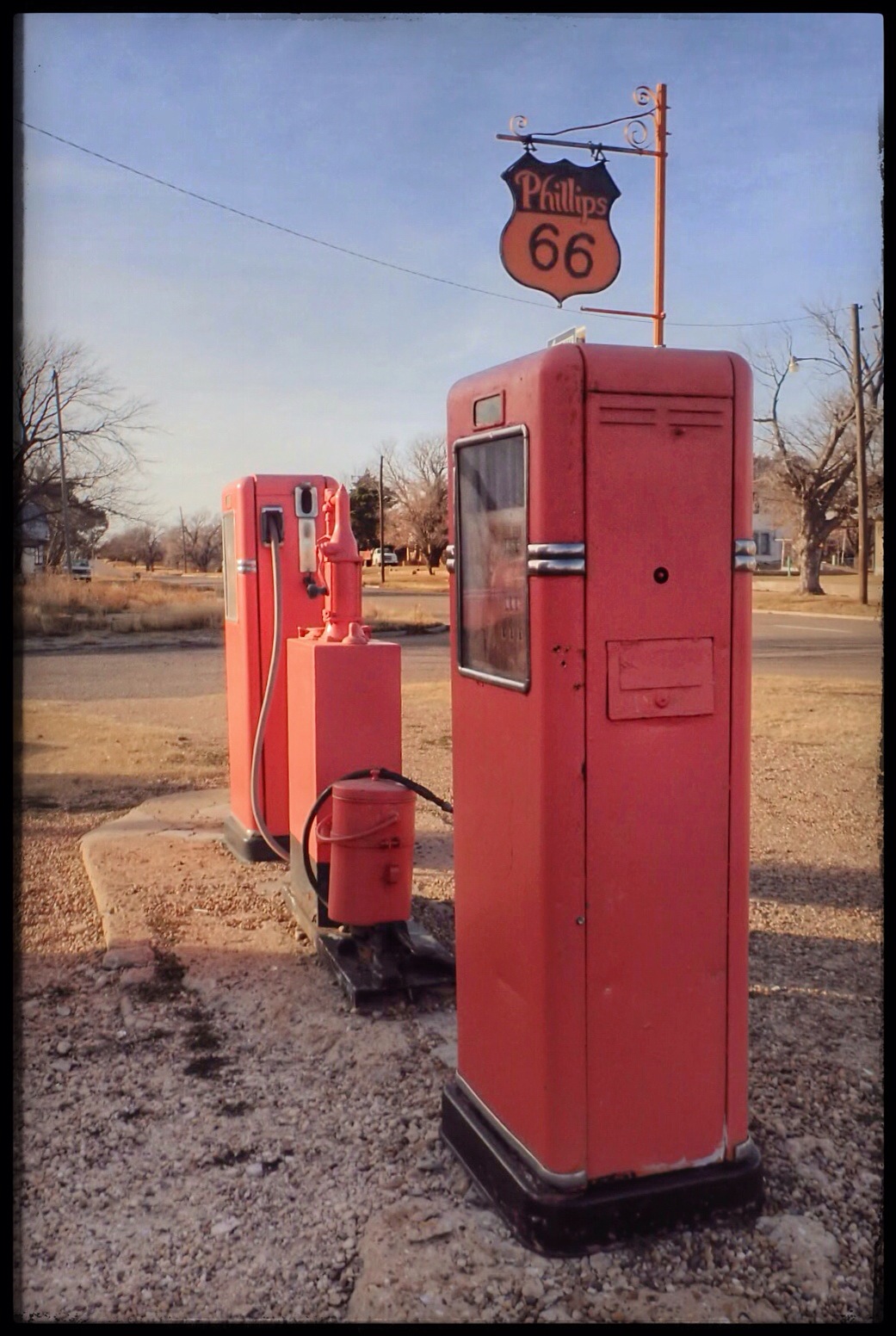
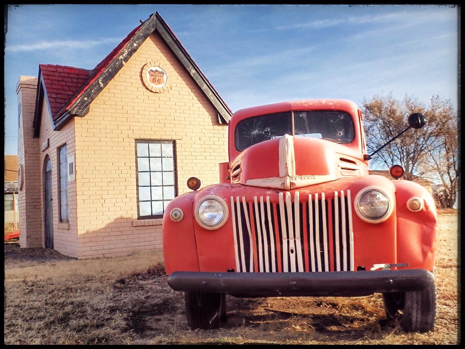
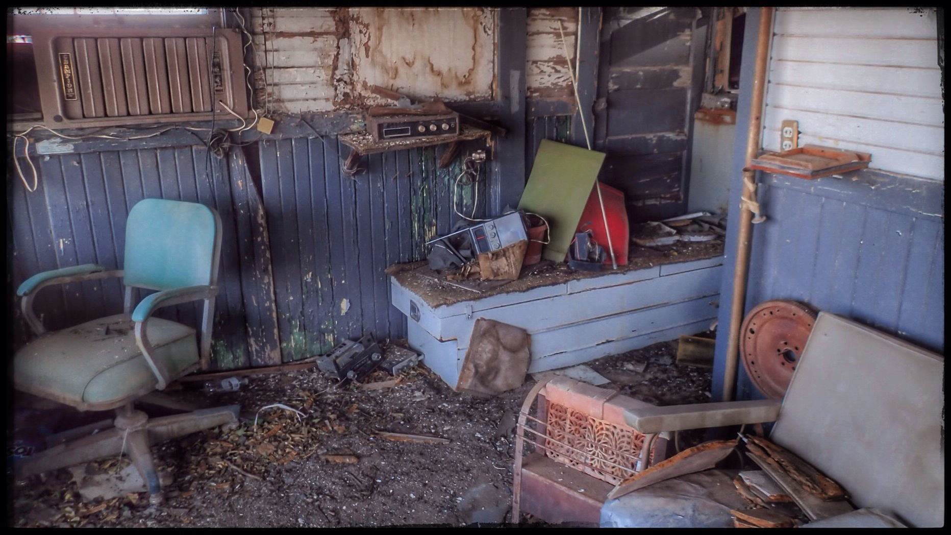
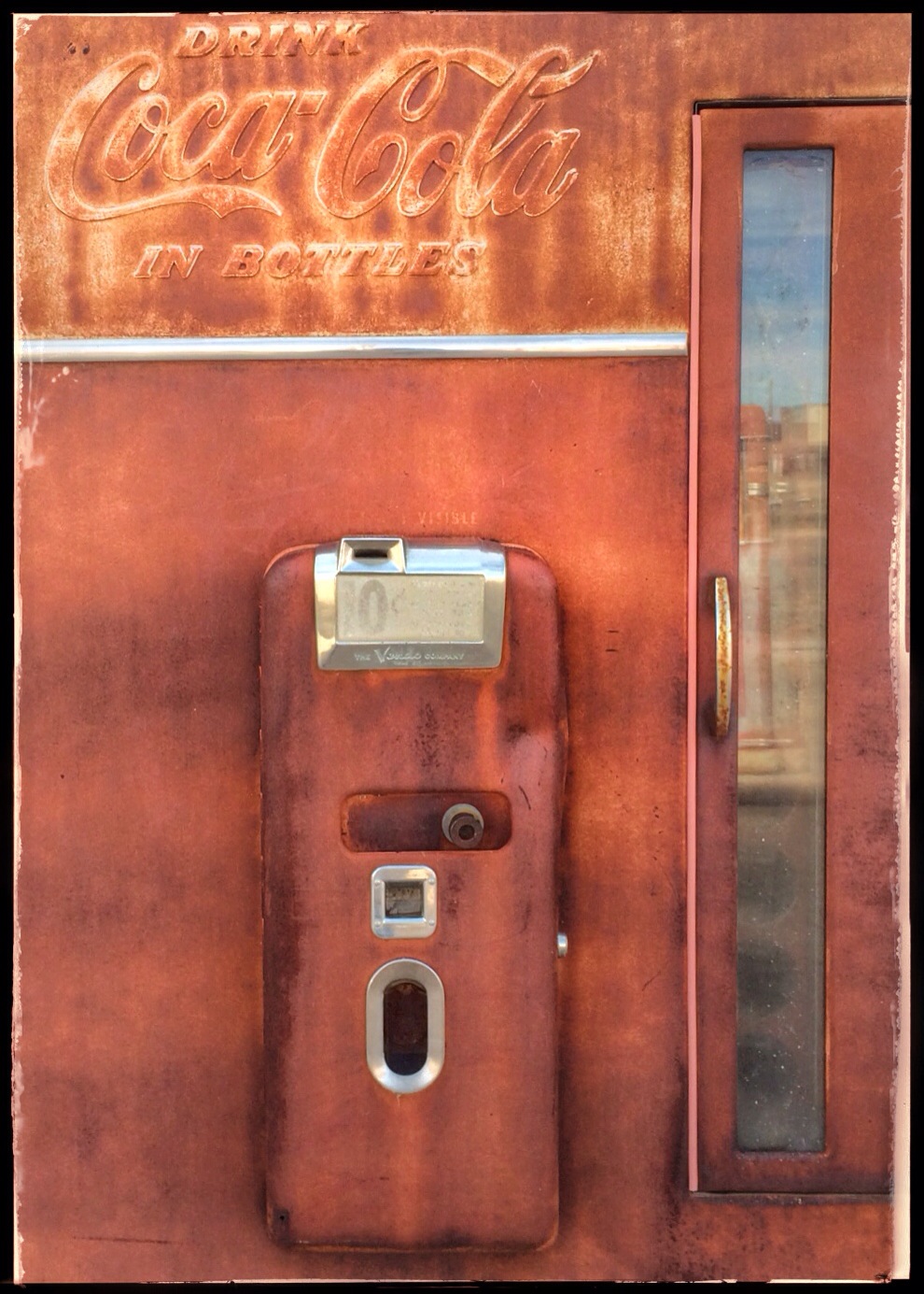
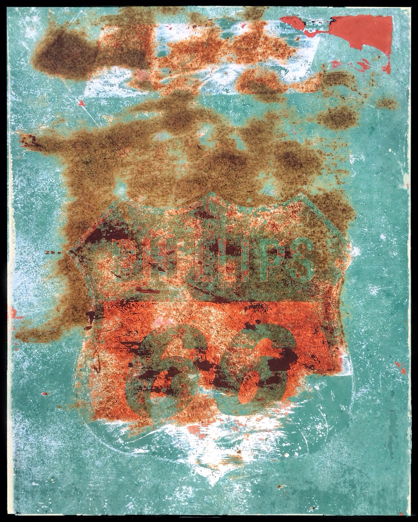
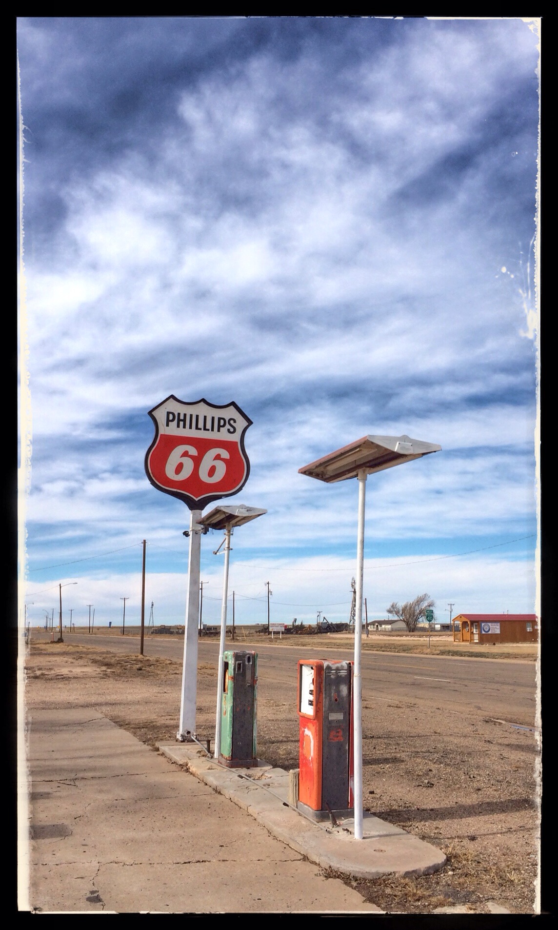
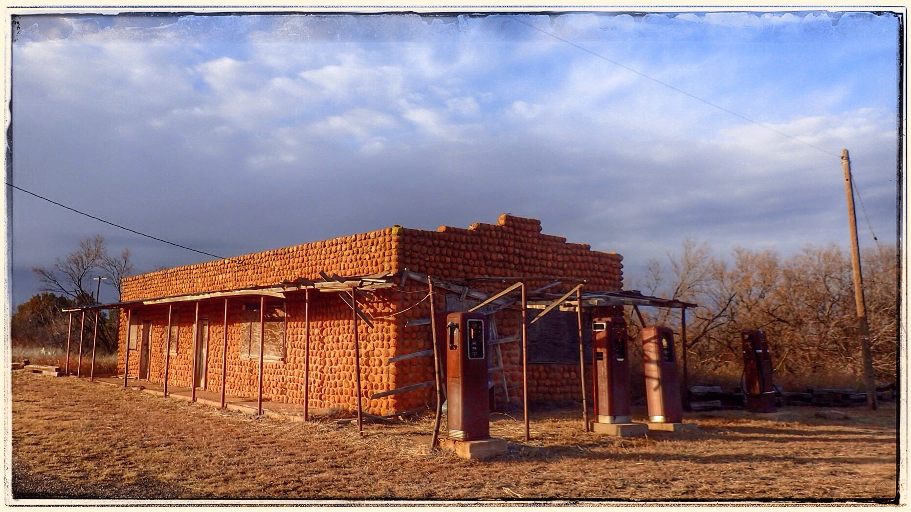
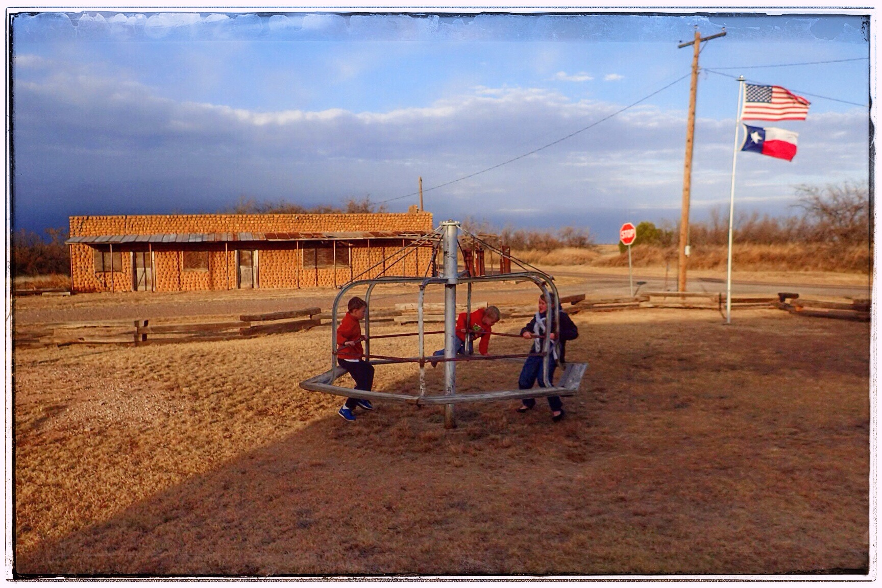
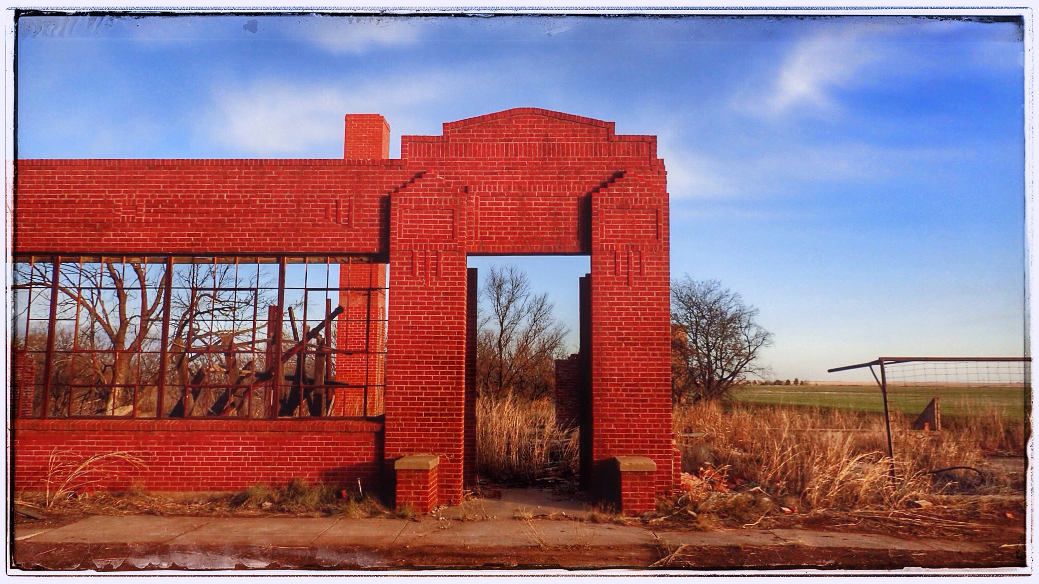
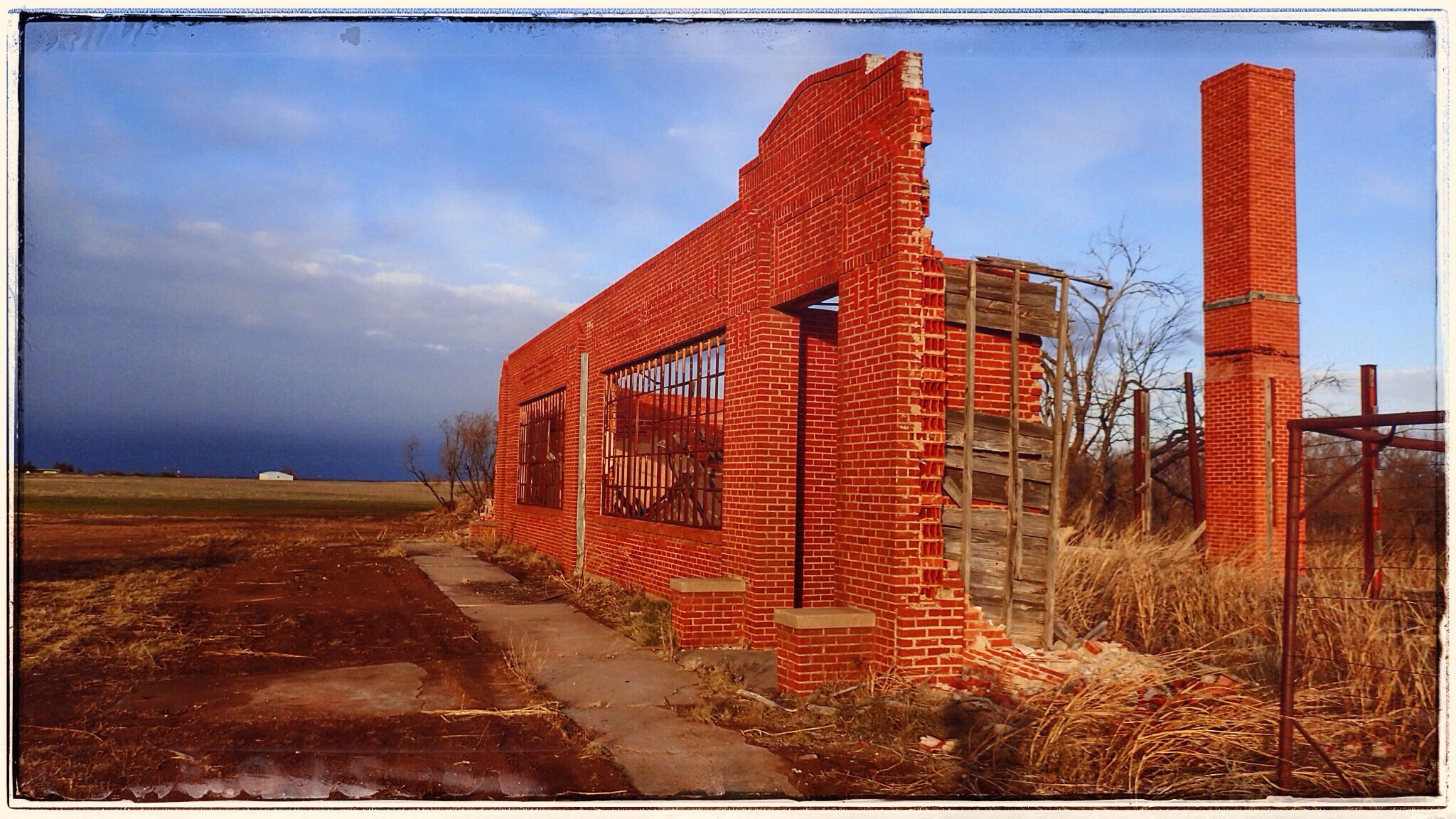
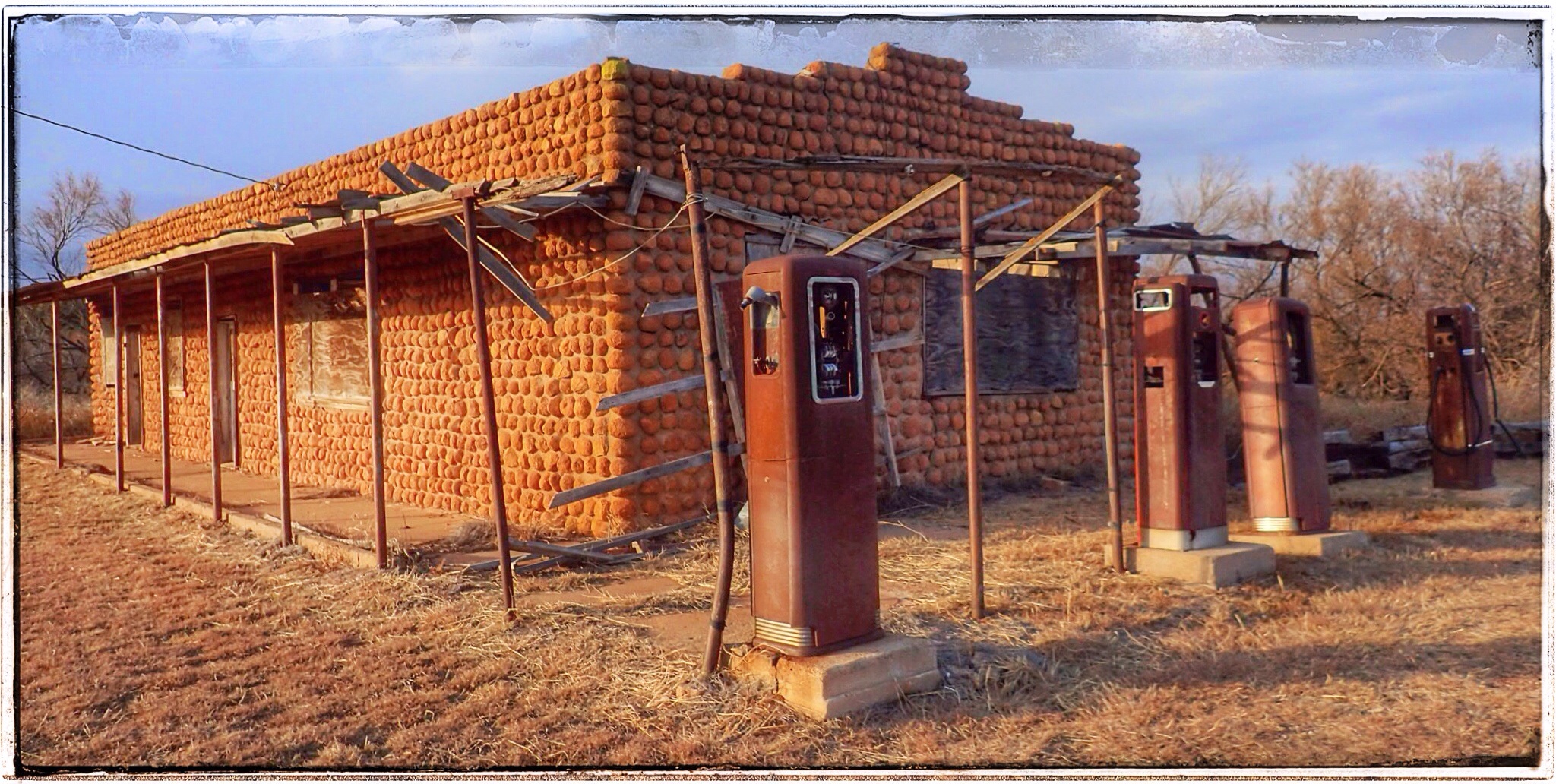
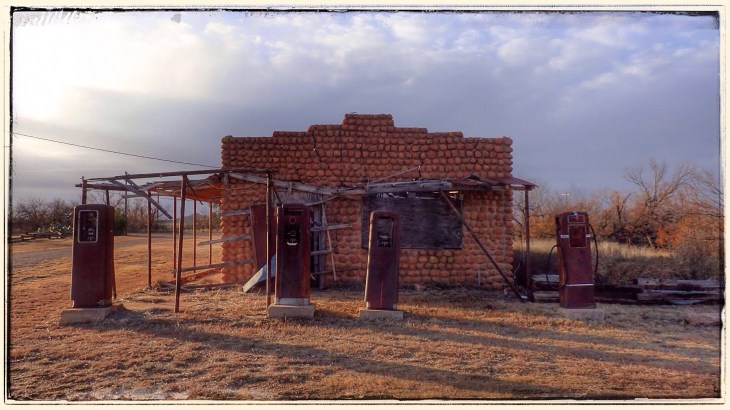
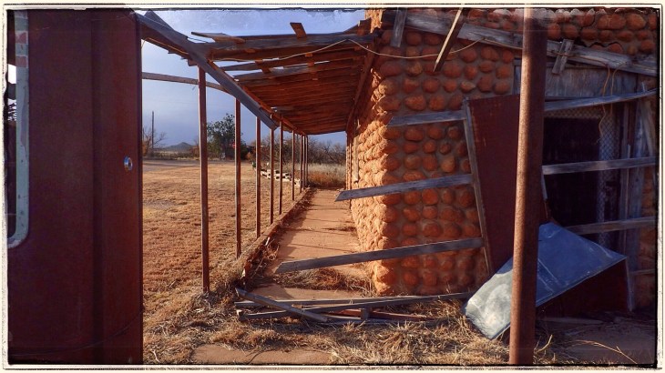
There are essentially three buildings left in town: 1.) The Cole building, which is now a museum run by a town native who lives nearby. We hear she opens for a few hours on Saturdays, but it wasn’t while we were there. 2.) The gas station, which is FLIPPING AWESOME with the old gas pumps still standing out front. 3.) The schoolhouse which is maybe 500ft away, down a dirt road (yet we were lucky enough that it was MUDDY!).

Between the buildings is a little merry-go-round, so while I was kodaking at the gas station and Mark was peeking around the Cole building, the kids got to run wild. Since the biting wind had numbed our ears and we didn’t want muddy kids in the car, we drove to the schoolhouse and I jumped out and sacrificed my boots for some great pictures.


This place was really cool. And if it hadn’t been so windy and cold, and had the museum been open, and had the sun not been so close to setting, we might-would have stayed and kodaked a little longer.

Ok, back to the history. What happened to Medicine Mound?
At about 3:00am on March 31, 1933, Mrs Ella Tidmore BURNED DOWN THE TOWN.
The sad story of the Tidmore family was mostly a well-kept, small-town, secret for more than 65 years. The act of arson was not investigated (or even reported) although over $50,000 (about $1M today) in damage had been done, and all but 2 buildings in Medicine Mound were burned to the ground.
The Tidmores were one of the first families to settle in Medicine Mound, arriving before the railroad in 1902. By all accounts, the Tidmores were the perfect family. They were socially prominent, wealthy, active members of the community. Jim Tidmore was a deacon in the church and had higher ambitions than farming– he opened the town’s first commercial real estate venture. The large, extended Tidmore family was well liked, healthy, intelligent, and good looking. But when things went bad, they went BAD. Unrequited love, extramarital affairs, prison sentences, suicide, multiple divorces, several attempted murders, drowning, untimely deaths, theft, well poisonings, several acts of arson and a tale of insanity so incredible– really, you’ve got to read it to believe it.
The lasting effect the Tidmore family had on Medicine Mound happened on the windy night of March 31, 1933. It was 3am when Ella, by then completely insane, set fire to the barber shop on the south end of town. As the fierce south winds whipped across the plains, it wasn’t long before the entire town was engulfed in flames, leaving only two businesses standing. Even the bank vault collapsed, destroying all the town and financial records. Throughout it all, neighbors said they saw Ella standing on her front lawn, laughing.
Between the destruction in 1933, a freak snowstorm in April 1938, WWII, and the Industrial Revolution, Medicine Mound quickly became one of Texas’ most fascinating ghost towns.
(Full story here: http://texashistory.unt.edu/ark:/67531/metapth26723/m1/20/)
If you have time to click around this book, it’s so awesome. It’s a book filled with hilarious (and sometimes tragic) small town stories and gossip. There is some fantastic stuff in there. I wanted to buy a copy, but I could only find one online for sale, and it was $135.00. Yeah. No. But, I have read a bunch of the stories, and from one of them, I added a new word to my vocabulary:
KODACING (or KODAKING).
the -ing form of the word, appropriate in almost every situation, of the word Kodak. As in the camera/film/etc. company. In the book, it’s spelled with a “c,” but I prefer a “k.” Example: While in Medicine Mound, I enjoyed kodaking around the town. A common pastime in Medicine Mound in the 1920s was kodaking on the Mounds. Unfortunately I don’t get to use many Kodak products anymore, but it’s my homage to George Eastman!!! It’s so DORKY it’s AWESOME!!!!

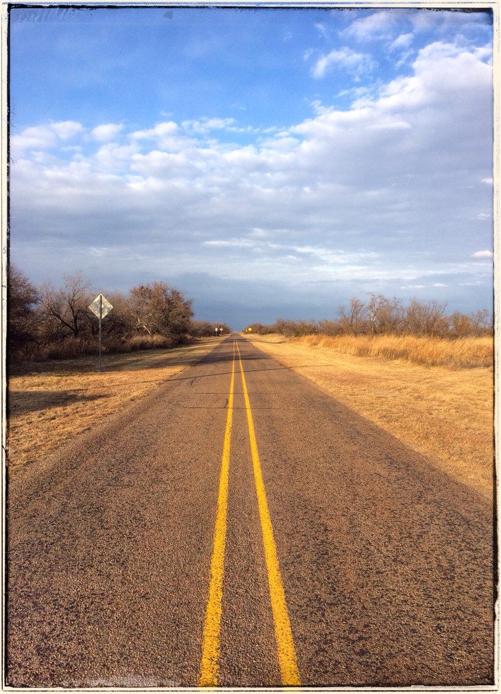
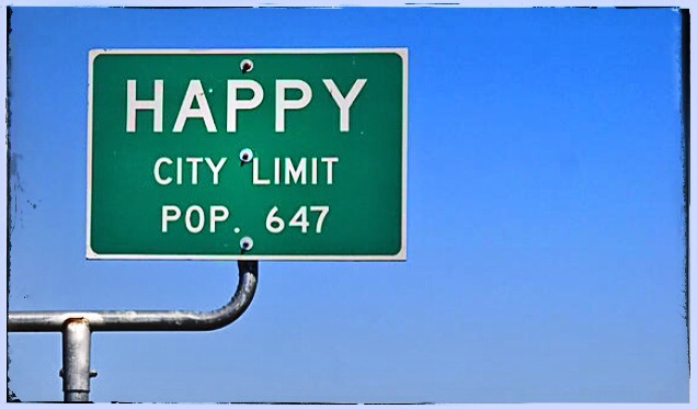
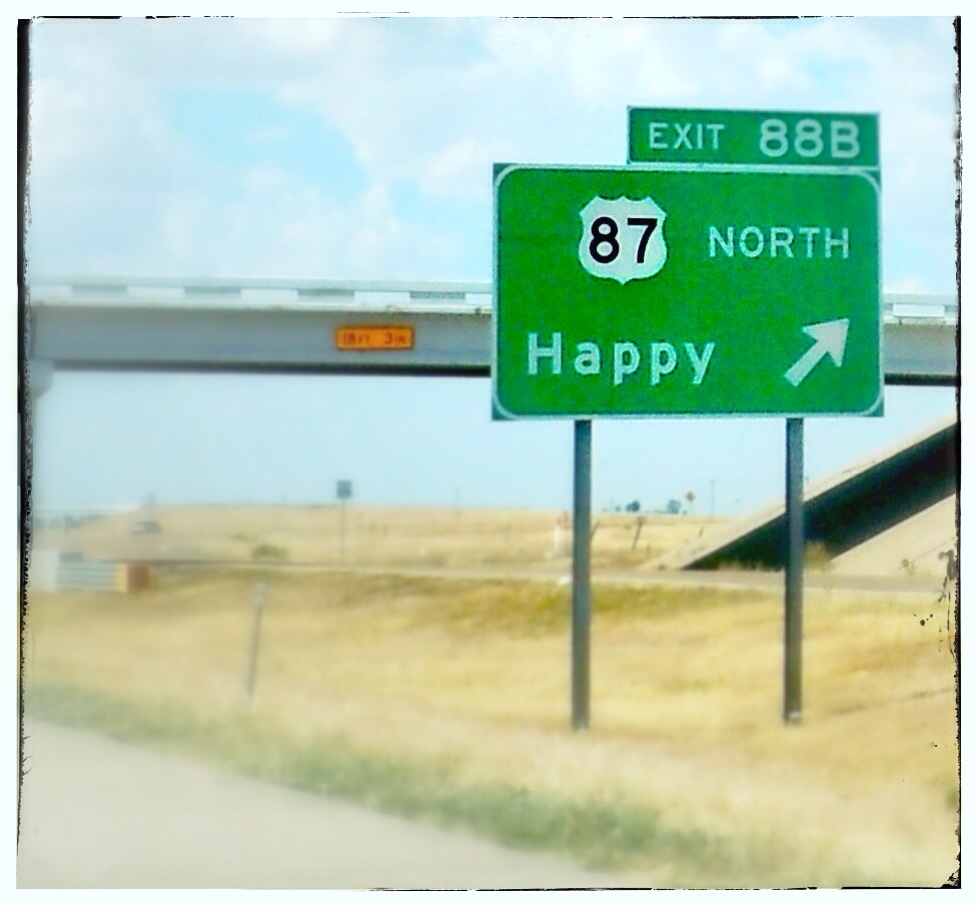
 Legend has it that around 1890, a team of parched cowboys found a stream in the area and named it “Happy Draw” because they were, well, happy to have found some water in this otherwise arid land. A post office and stagecoach exchange station set up shop by the draw, but when the town of Happy was laid out in 1906, they decided to move it two miles to the west to be closer to the new Santa Fe Railroad extension.
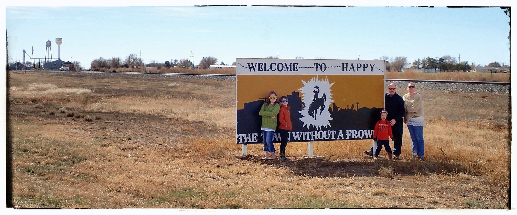
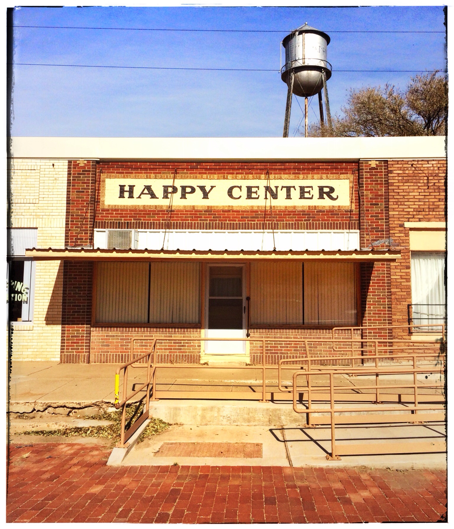 We drove down (literally) every single street in the town of Happy in search of food. We crossed our fingers and toes, praying for a diamond-in-the-rough mom and pop diner or a gas station with an ample selection of edible garbage. But, alas, Happy made us categorically unhappy in the victual department. So we bid a fond farewell to The Town Without a Frown (or, The Town Without A Dairy Queen) and hit the open roads, in search of sustenance and adventure.